
| |
|
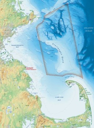
Wreck sites: Eastern coast of the United States
Massachusetts coastListed below by year of sinking:RMS Republic (1909) F/V Ocean (1938) Lighter YF415 (1944) F/V Baby Doll (1949) F/V Albatross (1952) F/V Eva II (1965) F/V Angela C (1981) F/V Joey (1985) F/V Rumors (1989) F/V Nyanza (1990) F/V Josephine Marie (1992) F/V Gambler (1994)
The RMS Republic was a Royal Mail Ship, carrying mail as well as passengers.
External sites The 570-foot passenger liner RMS Republic set sail on January 22, 1909 from New York, headed for the Mediterranean. On January 23, the liner attempted to cross the busy shipping lanes south of Nantucket Island. Hearing a foghorn around 6 am, the captain ordered all engines stopped, as they tried to ascertain where it was coming from. The Italian immigrant ship Florida, bound for New York, came out of the fog on the Republic's port side. The majority of the passengers were refugees from the Italian town of Messina, which had recently been destroyed by an earthquake. The bow of the Florida rammed into the Republic amidships. The Republic's engine room flooded immediately. The engine crew escaped, sealing the water tight doors. The captain ordered the wireless operator to broadcast the C-Q-D signal. (This signal predated the SOS signal. C-Q-D means Come - Quick - Danger.)** Although rising water had shorted out the main power supply, the emergency power was working, and the wireless operator was able to send the signal. [**So says Coleman. Other marine sites define it differently.] There was a wireless station at Siaconset on Nantucket Island. An operator there picked up the C-D-Q and relayed word of the collision and the position of the ships. 64 miles to the east, the SS Baltic was sailing from Liverpool on its way to New York. Her captain calculated that he was three hours away from the Republic. He gave orders to head for her. The bow of the Florida was damaged, but the collision bulkhead just behind the bow still held, and there was no danger of her sinking. The passengers were transferred, in about two hours, from the Republic to the Florida. Afterwards, the Florida remained at the Republic's side. The Republic's crew had placed a large piece of canvas over the hole caused by the collision, but this did little good. She burned a single green light, which also did little good. The Baltic, in its attempt to find the Republic had taken a zig-zag course. Finally the Republic started firing off signal rockets which enabled the Baltic to close within 100 feet of the liner. The 1,500 passengers and crew from the Republic were now transferred from the Florida by lifeboat to the Baltic. The Baltic and the Florida then continued on to New York. The Revenue Cutter Gresham found the trio of ships shortly after the transfer to the Baltic had been completed. The Gresham took the Republic under tow, but the Republic was settling at the rate of about one foot an hour and the captain of the Gresham ordered the tow rope to be cut. At about 8:40 pm, 39 hours after the collision, the Republic sank beneath the waves, stern first. She split in two on the way down, and her pieces hit the surface 260 feet below. As of 1991, the stern of the Republic sits upright, while the bow section rests at a 90-degree angle to her starboard side. The Republic is rumored to have been carrying gold coins. As of 1991, at least three salvage attempts had been made. One in 1930, one in 1987, and one in 1988. In the latest attempt, it was revealed that at least some sections of the ship were under 20 feet of mud. The location of the Republic is well-known to fishermen, who treat it as a man-made reef. Cod, pollock, and hake are caught around it.
The rest of the story The Republic was not expected to sink, indeed it was thought unsinkable. Therefore, no luggage and no cargo had been removed from the ship. No enquiry into the collision and sinking was held, despite the fact that one was legally required. The official website of the RMS Republic gives more - and different - information about the C - D - Q signal.
Bibliography

The trawler Ocean was partially constructed at Globe Ship Building in Superior, Wisconsin in 1918. It was brought through the Erie Canal to East Boston where it was completed and fitted out for duty. The Ocean, owned by the Bay State Fishing Company (located on the Fish Pier in Boston) was a steel vessel, 135 feet long with a 22-foot beam, powered by steam. In 1938, it was decided to scuttle the Ocean as obsolete. On April 26, 1938 the tug Pow Wow towed the Ocean to a point six miles east of the Boston Lightship, at position 42-23 X 70-35. Her sea cocks were opened and she sank down onto the ocean floor 270 feet below. The wreck was placed on charts at both the Army Corps of Engineers, National Ocean Service and later by the U.S. Navy during WWII. She was carried on the old Navy restricted shipwreck list as wreck #149. As of 1997, the Ocean still rose at least 18 feet off the bottom. The wreck is but one of at least 60-plus wrecks in a 10-mile area outside the B Buoy, known as the Boston Dump.
YF415 was built at the Niagara Shipbuilding Corporation in Buffalo, N.Y. She was completed in 1943 and put into service with the First Naval District on October 15, 1943. From then until May 11, 1944; the 132-foot steel vessel performed a variety of functions for the Navy. The lighter had a crew of 29 officers and enlisted men. On May 11, 1944, the lighter was about 14 miles offshore. Its mission was to dump condemned ammunition from the Hingham depot. The dumping was almost complete when something exploded, and the deck became ablaze with fire. The chief made his way to the stern, tossing life preservers over the side to assist those jumping into the water. He placed a life preserver over the body of a badly-burned crew member who had come up from below, lowered him over the side, and then jumped into the water himself. Thirty-five minutes after the explosion, the YF415 sank in position 42-24 x 70-36. A Navy weather ship nearby heard the explosion, and arrived to rescue the survivors. By approximately 1 p.m. they had 13 onboard, including the badly-burned individual who would die later in hospital. 17 men died in total. The Fisherman, February 9, 1995, Tim Coleman
In the early morning of May 2, 1949 the fishing vessel Baby Doll, out of Gloucester, was heading into New Bedford with a load of yellowtail flounder in her hold. At about 6 a.m. a fire broke out, when the vessel was about two miles inside the hole. The Coast Guard cutter Legare was dispatched to the scene - but by the time she arrived the captain and crew had been removed by another dragger. The Baby Doll sank shortly after the Legare arrived in roughly 52 feet of water, at 41-28 X 70-49 . The cutter marked the spot with a buoy and then returned to New Bedford. The NOS ship Rude located the wreck at this spot during side scan operations in the bay during 1995. Other wrecks in this area include the U.S.S. Yankee, the barge Sherwood and the F/V Uncle John. Bibliography: The Fisherman, February 27, 1997, Tim Coleman
The 100-foot dragger Albatross from Gloucester was making way in heavy seas on the morning of June 20, 1952. At about 2:30 am, about three miles off Highlight Light, she collided with the 10,000-ton tanker Esso Chattanooga. Full details fo the collision are given at the United States Coast Guard site. At an enquiry held afterward, the crews of both ships gave conflicting statements. The man on watch on the fishing boat said the tanker was on them before he knew it. He stated that he heard no whistle, and put the visibility at eight or 10 miles. The captain of the tanker said the fishing boat made a course change seconds before the collision. Prior to that he said there was ample room to pass. Twelve members of the dragger�s crew got into the dory to abandon ship. The captain was the last to leave. Deciding that the dory was too crowded, he refused to board her, and instead leapt overboard, and disappeared, presumed drowned. The crew members were brought aboard the tanker. Several hours were spent searching for the captain's body but without success. The tanker then brought the crew members into Boston.
The wreck itself lies in 120 feet of water, its profile rising 12 feet or more from the botto, at 42-01 X 69-59.
On the morning of February 28, 1965, the 42-year-old dragger, Eva II headed out before first light to the drag grounds southeast of Gloucester. The crew consisted of the captain and one other man. Shortly after 5:30 a.m. the crew began hauling back the net when the winch stuck, causing one of the doors to come in hard against the hull below the waterline on the starboard side. The heavy door punched a hole in the hull and water flooded in. The two men abandon ship, taking refuge in their dory. As they pulled away from the Eva II, she settled by the stern, and finally sank into roughly 170 feet of water at position 42-33 X 70-36. She came to rest on the east side of a small hill. The wreck of the Eva was located in the fall of 1996 by Tim Coleman, with the help of Capt. Phil Hoystadt on the Yankee Patriot. The 50-foot wreck rises about six to eight feet at her highest point. Fishermen visit her for the small to medium cod which abound there. The Eva is close enough to the shore so that people in small boats can access her easily.
Bibliography
The Angela C, a western rig dragger, was fishing about 12 miles off Eastern Point light at 4:30 in the morning. Just before first light, the captain smelled smoke in the engine room. When he investigated, he found that the fire - however it had started - was well under way and there was no possibility of putting it out. The captain radioed the F/V Spray, which came alongside and took off both the captain and the single crew member. Another dragger, the Anthony and Josephine, radioed the Gloucester Coast Guard which dispatched Coast Guard-41399 to the scene. When it arrived, the cutter found the Angela C in flames and listing. There were two propane cylinders and 400 gallons of diesel on board, so the coxswain of the cutter decided to stand off, rather than fight the fire. The fire soon burned through thehfull and the Angela C sank at roughly 42-25 X 70-33. This position put it roughly east of the A buoy, not far from the Sand Ridge and the Northwest Corner of the bank in roughly 270 feet of water. A wreck mark was placed on chart 13267 the next time it was updated and the Angela C was also entered in the National Ocean Service official records. In 1992, the wreck was located with side scan sonar, both by the EPA, doing work on the sea floor, and a research trip by the U.S. Department of the Interior, which put its location at 42-25.7 X 70-33.5. Bibliography: The Fisherman, Tim Coleman, April 15, 1999
The F/V Joey, built in 1957 in St. Augustine, Florida, 61 feet long with a 9-foot beam, with the captain and a single crew member, was out early in the morning on November 14, 1985, about 10 miles east of Thatcher's Island, off Cape Ann, Massachusetts. The weather was clear, winds were from the north-northeast at 10 to 12 knots, with gusts to 25. Seas were running 6 to 8 feet. The Joey rendezvoused with the F/V Starlight, and received from it a load of 99,000 pounds of herring, which it was to transport to shore. The Joey then headed back towards Gloucester. Only a short time later, the captain noted that the ship was flooding, but was unable to locate the source of the leak. The Joey had four bilge pumps, but the crew were unable to get any of them to work. The captain sent out a distress call, which was picked up and relayed to the Gloucester Coast Guard by a third boat nearby. The master of the Starlight heard the mayday also and returned to the Joey, taking off the crew. They were brought to the Gloucester Sea Buoy, where they were transferred to a Coast Guard vessel and brought back to Fishtown. The Joey sank in position 42-41 X 70-25, close to a section of the south end of Jeffery�s called the Flat Ground, in about 160 to 165 feet of water. There are other wrecks not far away, including the Dale, Born Free and the Jackie B. Fishermen fish these wrecks for cod. Bibliography: The Fisherman, April 1, 1999, Tim Coleman
The F/V (fishing vessel) Rumors sunk on the night of January 2, 1989. The ship, with lobster traps aboard, was heading home on a northerly course. The seas were calm, the temperature was about 34 degrees, the wind was out of the southeast at about 15 knots. The captain was running the ship and the crew was below, when the bilge alarm went off. The captain discovered rising water in the engine room. He ordered the ship lightened, and lobster traps were flung overboard. The life raft was also made ready and the crewmembers put on their survival suits. The crewmember could not locate the source of the leak, and soon afterwards the 42-foot steel boat heeled over to port and sank in roughly 265-275 feet of water. All hands survived. The Coast Guard theorized that the cause of the sinking was a broken or loose water hose that went undetected. The Boston Dumping Grounds is home to quite a few sunken ships. There are more than 100 ships wrecked in roughly 15 square miles.
Bibliography
On January 19, 1990, the 64-foot Nyanza, a 42-year old dragger, was dragging for shrimp off the coast of Massachusetts. The weather turned against them, with winds to 25 mph and four foot seas, so around 10 am the captain decided to head back to Cape Ann. It was only fifteen minutes later, when they were about 10 miles east of Gloucester, that the Nyanza hit something unknown - possibly a log. The crew checked for damage and saw seas washing in by the stern, around the rudder post. The pumps were started, but to no avail. The crew abandoned ship but were picked up immediately by the F/V Spray, which had been nearby. The Spray notified the Gloucester Coast Guard. When the Coast Guard Cutter Adak arrived, the Nyanza was down by the stern, with a 40 degree list. Four minutes later, t he shrimp dragger sank beneath the waves and down into deep water. Anglers fish the wreck for cod.
Bibliography
Bibliography
It was around 1 p.m. on April 3, 1994. The Hyannis- based, 65-foot dragger Gambler was working 3.5 miles east of Gurnet Point on the South Shore of Massachusetts. The wind was blowing 20 from the southwest; the air temp was 35 degrees and the water, 38. A crewman checked the engine room to discover four feet of rising water coming from an unknown source. The captain immediately radioed the Coast Guard, who launched helicopters and a 41-foot cutter from Scituate. The Plymouth Harbor Master also headed for the Gambler. The helicopter dropped two pumps down to the ship, but the crew was unable to stop the flooding. About 2 hours later, at 3 pm, the captain and crew were transferred to the Coast Guard boat and brought to the Plymouth town wharf. Meanwhile, the Gambler rolled on its side and disappeared into 112 feet of water, at position 42-01 X 70-31.
Today the Gambler serves as an artificial reef on the floor of Cape Cod Bay. Anglers fish for cod there.
|
|

All text © 2006, 2007 The Thunder Child unless otherwise credited.
All illustrations retain original copyright.
Please contact us with any concerns as to correct attribution.
Any questions, comments or concerns please contact us